East side · Public Square E
124 Public Square E.
Variety store; pool hall in the basement
Today From our directory, Nov. 1, 2026. Please check with a business before you go.
Then Have an old photo of this storefront? Share it Now Send us a photo of 124 Public Square E today. Send a photo
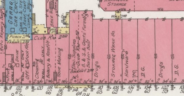
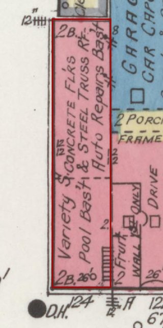
On the old maps: no. 124 on the 1921 map
Then: 1921 map Map: Sanborn Map Co., Sept. 1921, sheet 3, Library of Congress (public domain). Cropped; red outline added by Our Town Almanac.
1921 Variety store; pool hall in the basement map label: Variety S.; Pool Bas't Library of Congress, sheet 3 1982 historic-district record: NRHP entry #2. NRHP #2 Cooper ca. 1880s–90s (1982: 124 N. Main). Map notes concrete floors & steel-truss roof; auto repairs basement behind. (NRHP nomination 82001725 )
Know something about this building? Tell us · Have an old photo of it? Share it
East side · Public Square E
122 Public Square E.
Fruit (first floor only)
Today No directory listing matched this address on Nov. 1, 2026.
Then Have an old photo of this storefront? Share it Now Send us a photo of 122 Public Square E today. Send a photo
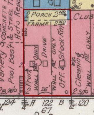
On the old maps: no. 122 on the 1921 map
Then: 1921 map Map: Sanborn Map Co., Sept. 1921, sheet 3, Library of Congress (public domain). Cropped; red outline added by Our Town Almanac.
1921 Fruit (first floor only) map label: Fruit (1st only) Library of Congress, sheet 3 1982 historic-district record: NRHP entry #3. NRHP #3 Cooper ca. 1900 (1982: 122) (NRHP nomination 82001725 )
Know something about this building? Tell us · Have an old photo of it? Share it
East side · Public Square E
120 Public Square E.
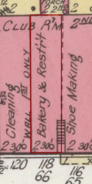
Bakery and restaurant
Today From our directory, Nov. 1, 2026. Please check with a business before you go.
Then Have an old photo of this storefront? Share it Now Send us a photo of 120 Public Square E today. Send a photo
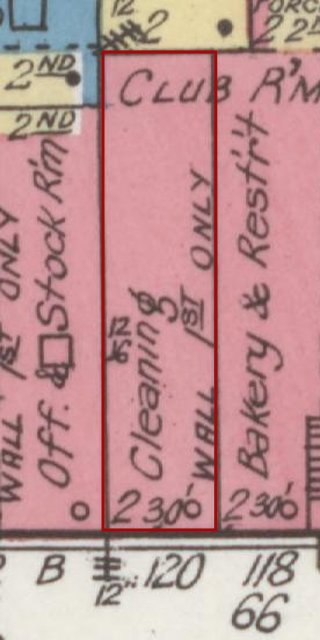
On the old maps: no. 120 on the 1921 map
Then: 1921 map Map: Sanborn Map Co., Sept. 1921, sheet 3, Library of Congress (public domain). Cropped; red outline added by Our Town Almanac.
1921 Bakery and restaurant map label: Bakery & Rest'r't Library of Congress, sheet 3 1982 historic-district record: NRHP entry #4. NRHP #4 Scudder ca. 1900 (1982: 116–120) (NRHP nomination 82001725 )
Know something about this building? Tell us · Have an old photo of it? Share it
East side · Public Square E
118 Public Square E.
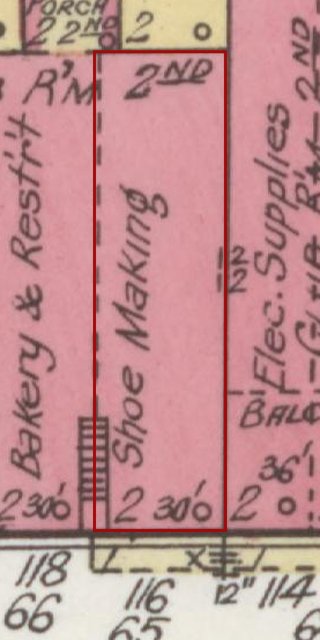
Shoe making
Today From our directory, Nov. 1, 2026. Please check with a business before you go.
Then Have an old photo of this storefront? Share it Now Send us a photo of 118 Public Square E today. Send a photo Know something about this building? Tell us · Have an old photo of it? Share it
East side · Public Square E
116 Public Square E.
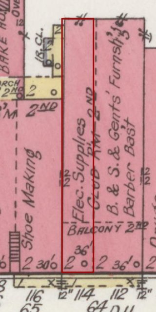
Electrical supplies
Today From our directory, Nov. 1, 2026. Please check with a business before you go.
Then Have an old photo of this storefront? Share it Now Send us a photo of 116 Public Square E today. Send a photo Know something about this building? Tell us · Have an old photo of it? Share it
East side · Public Square E
114 Public Square E.
Drugs
Today No directory listing matched this address on Nov. 1, 2026.
Then Have an old photo of this storefront? Share it Now Send us a photo of 114 Public Square E today. Send a photo
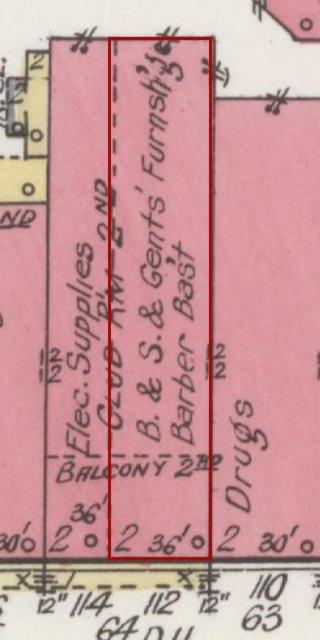
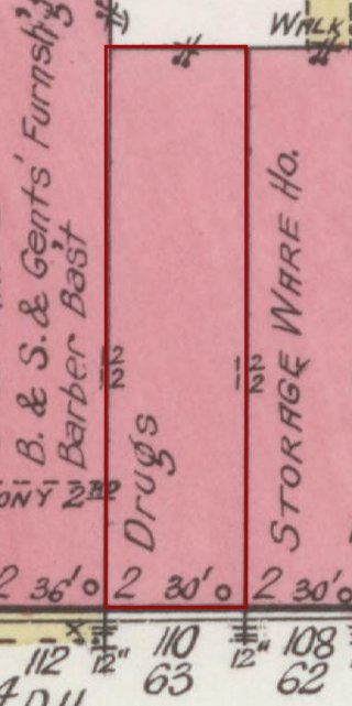
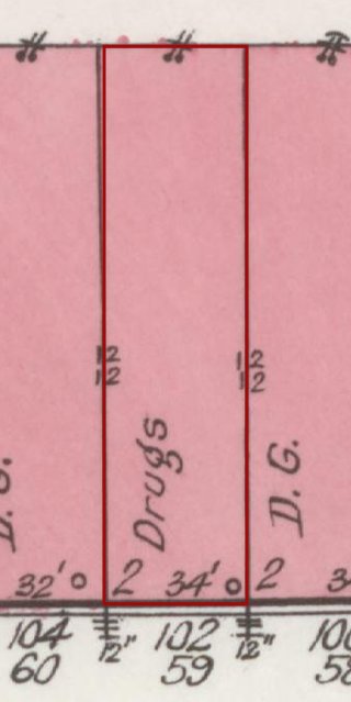
On the old maps: no. 114 on the 1921 map
Then: 1921 map Map: Sanborn Map Co., Sept. 1921, sheet 3, Library of Congress (public domain). Cropped; red outline added by Our Town Almanac.
1921 Drugs map label: Drugs Library of Congress, sheet 3 1982 historic-district record: NRHP entry #5. NRHP #5 Scudder early 20th c., three-story (1982: 112–114) (NRHP nomination 82001725 )
Know something about this building? Tell us · Have an old photo of it? Share it
East side · Public Square E
112 Public Square E.
Drugs
Today From our directory, Nov. 1, 2026. Please check with a business before you go.
Then Have an old photo of this storefront? Share it Now Send us a photo of 112 Public Square E today. Send a photo Know something about this building? Tell us · Have an old photo of it? Share it
East side · Public Square E
110 Public Square E.
Hardware
Today From our directory, Nov. 1, 2026. Please check with a business before you go.
Then Have an old photo of this storefront? Share it Now Send us a photo of 110 Public Square E today. Send a photo
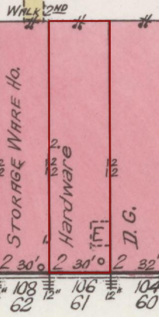
On the old maps: no. 110 on the 1921 map
Then: 1921 map Map: Sanborn Map Co., Sept. 1921, sheet 3, Library of Congress (public domain). Cropped; red outline added by Our Town Almanac.
1921 Hardware map label: Hardw. Library of Congress, sheet 3 1982 historic-district record: NRHP entry #6. NRHP #6 Brantley ca. 1870s (1982: 110) (NRHP nomination 82001725 )
Know something about this building? Tell us · Have an old photo of it? Share it
East side · Public Square E
108 Public Square E.
Hardware; storage warehouse behind
Today From our directory, Nov. 1, 2026. Please check with a business before you go.
Then Have an old photo of this storefront? Share it Now Send us a photo of 108 Public Square E today. Send a photo
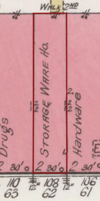
On the old maps: no. 108 on the 1921 map
Then: 1921 map Map: Sanborn Map Co., Sept. 1921, sheet 3, Library of Congress (public domain). Cropped; red outline added by Our Town Almanac.
1921 Hardware; storage warehouse behind map label: Hardw. / Storage Ware Ho. Library of Congress, sheet 3 1982 historic-district record: NRHP entry #7. NRHP #7 Woosley ca. 1870s Italianate (1982: 108) (NRHP nomination 82001725 )
Know something about this building? Tell us · Have an old photo of it? Share it
East side · Public Square E
106 Public Square E.
Dry goods
Today No directory listing matched this address on Nov. 1, 2026.
Then Have an old photo of this storefront? Share it Now Send us a photo of 106 Public Square E today. Send a photo
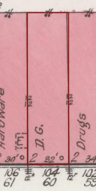
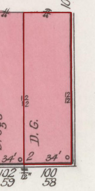
On the old maps: no. 106 on the 1921 map
Then: 1921 map Map: Sanborn Map Co., Sept. 1921, sheet 3, Library of Congress (public domain). Cropped; red outline added by Our Town Almanac.
1921 Dry goods map label: D.G. Library of Congress, sheet 3 1982 historic-district record: NRHP entry #8. NRHP #8 Hulan ca. 1870s Italianate (1982: 106) (NRHP nomination 82001725 )
Know something about this building? Tell us · Have an old photo of it? Share it
East side · Public Square E
104 Public Square E.
Dry goods
Today From our directory, Nov. 1, 2026. Please check with a business before you go.
Then Have an old photo of this storefront? Share it Now Send us a photo of 104 Public Square E today. Send a photo
On the old maps: no. 104 on the 1921 map
Then: 1921 map Map: Sanborn Map Co., Sept. 1921, sheet 3, Library of Congress (public domain). Cropped; red outline added by Our Town Almanac.
1921 Dry goods map label: D.G. Library of Congress, sheet 3 1982 historic-district record: NRHP entry #9. NRHP #9 Thompson-Burke ca. 1880s Romanesque Revival (1982: 104) (NRHP nomination 82001725 )
Know something about this building? Tell us · Have an old photo of it? Share it
East side · Public Square E
102 Public Square E.
Club room
Today From our directory, Nov. 1, 2026. Please check with a business before you go.
Then Have an old photo of this storefront? Share it Now Send us a photo of 102 Public Square E today. Send a photo
On the old maps: no. 102 on the 1921 map
Then: 1921 map Map: Sanborn Map Co., Sept. 1921, sheet 3, Library of Congress (public domain). Cropped; red outline added by Our Town Almanac.
1921 Club room map label: Club Rm Library of Congress, sheet 3 1982 historic-district record: NRHP entry #10. NRHP #10 McGrew ca. 1880s (1982: 102) (NRHP nomination 82001725 )
Know something about this building? Tell us · Have an old photo of it? Share it
East side · Public Square E
100 Public Square E.
Corner of Main and Depot
Today No directory listing matched this address on Nov. 1, 2026.
Then Have an old photo of this storefront? Share it Now Send us a photo of 100 Public Square E today. Send a photo
On the old maps: no. 100 on the 1921 map
Then: 1921 map Map: Sanborn Map Co., Sept. 1921, sheet 3, Library of Congress (public domain). Cropped; red outline added by Our Town Almanac.
1921 Corner of Main and Depot map label: (corner Main & Depot) Library of Congress, sheet 3 1982 historic-district record: NRHP entry #11. NRHP #11 Woosley ca. 1880s, crenelated parapet (1982: 100) (NRHP nomination 82001725 )
Know something about this building? Tell us · Have an old photo of it? Share it