Our Town Almanac
Shelbyville, Tennessee The Shelbyville Almanacpart of Our Town Almanac · directory, events, history & people · Bedford County, Tennessee · ZIP 37160

West side of the square: Public Square W

13 buildings. Walk south to north. On the 1921 map this side was N. Spring.

  1. 125
  2. 123
  3. 121
  4. 119
  5. 117
  6. 115
  7. 113
  8. 111
  9. 109
  10. 107
  11. 105
  12. 103
  13. 101

Each card gives what the Sept. 1921 fire insurance map shows for the storefront, with the label as printed and a link to the map sheet. Old lots are matched to today’s addresses by our reading of the 1921 numbers against today’s directory. How to read these cards · All sources

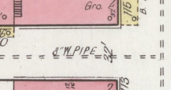
1921 Sanborn map detail of the west side of the Shelbyville courthouse square
The west side on the Sept. 1921 Sanborn map. Sanborn Map Co., sheet 2, Library of Congress (public domain). Cropped by Our Town Almanac.

West side · Public Square W

125 N. Spring St.

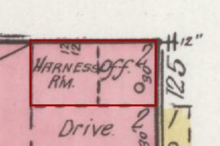
Harness room and office

Today

1921 N. Spring numbers do not line up with today’s Public Square W addresses, so this card has no per-building match. See the side list below for who is on the west side today.
  • ThenHave an old photo of this storefront?Share it
  • NowSend us a photo of 125 N. Spring (1921) today.Send a photo

No then-and-now photos here yet. Photos stay yours. How to share

On the old maps: no. 125 on the 1921 map

Sept. 1921 Sanborn fire insurance map detail with the lot at 125 N. Spring (1921) outlined in red; the map labels it: Harness Rm / Off.
Then: 1921 map

Map: Sanborn Map Co., Sept. 1921, sheet 2, Library of Congress (public domain). Cropped; red outline added by Our Town Almanac.

  1. 1921 Harness room and office map label: Harness Rm / Off. Library of Congress, sheet 2

Today's Public Square W numbers (100/105/110) do not line up with 1921 N. Spring odd numbers — no per-card today match.

West side · Public Square W

123 N. Spring St.

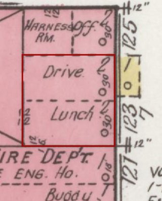
Drive and lunch room

Today

1921 N. Spring numbers do not line up with today’s Public Square W addresses, so this card has no per-building match. See the side list below for who is on the west side today.
  • ThenHave an old photo of this storefront?Share it
  • NowSend us a photo of 123 N. Spring (1921) today.Send a photo

No then-and-now photos here yet. Photos stay yours. How to share

On the old maps: no. 123 on the 1921 map

Sept. 1921 Sanborn fire insurance map detail with the lot at 123 N. Spring (1921) outlined in red; the map labels it: Drive; Lunch
Then: 1921 map

Map: Sanborn Map Co., Sept. 1921, sheet 2, Library of Congress (public domain). Cropped; red outline added by Our Town Almanac.

  1. 1921 Drive and lunch room map label: Drive; Lunch Library of Congress, sheet 2

West side · Public Square W

121 N. Spring St.

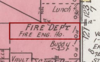
Fire department and fire engine house

Today

1921 N. Spring numbers do not line up with today’s Public Square W addresses, so this card has no per-building match. See the side list below for who is on the west side today.
  • ThenHave an old photo of this storefront?Share it
  • NowSend us a photo of 121 N. Spring (1921) today.Send a photo

No then-and-now photos here yet. Photos stay yours. How to share

On the old maps: no. 121 on the 1921 map

Sept. 1921 Sanborn fire insurance map detail with the lot at 121 N. Spring (1921) outlined in red; the map labels it: Fire Dept. / Fire Engine House
Then: 1921 map

Map: Sanborn Map Co., Sept. 1921, sheet 2, Library of Congress (public domain). Cropped; red outline added by Our Town Almanac.

  1. 1921 Fire department and fire engine house map label: Fire Dept. / Fire Engine House Library of Congress, sheet 2

Detective case clue.

West side · Public Square W

119 N. Spring St.

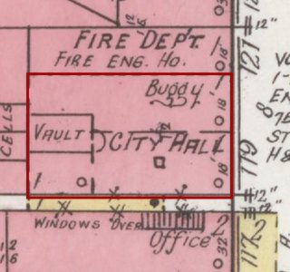
City Hall

Today

1921 N. Spring numbers do not line up with today’s Public Square W addresses, so this card has no per-building match. See the side list below for who is on the west side today.
  • ThenHave an old photo of this storefront?Share it
  • NowSend us a photo of 119 N. Spring (1921) today.Send a photo

No then-and-now photos here yet. Photos stay yours. How to share

On the old maps: no. 119 on the 1921 map

Sept. 1921 Sanborn fire insurance map detail with the lot at 119 N. Spring (1921) outlined in red; the map labels it: City Hall
Then: 1921 map

Map: Sanborn Map Co., Sept. 1921, sheet 2, Library of Congress (public domain). Cropped; red outline added by Our Town Almanac.

  1. 1921 City Hall map label: City Hall Library of Congress, sheet 2

West side · Public Square W

117 N. Spring St.

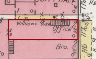
Office

Today

1921 N. Spring numbers do not line up with today’s Public Square W addresses, so this card has no per-building match. See the side list below for who is on the west side today.
  • ThenHave an old photo of this storefront?Share it
  • NowSend us a photo of 117 N. Spring (1921) today.Send a photo

No then-and-now photos here yet. Photos stay yours. How to share

On the old maps: no. 117 on the 1921 map

Sept. 1921 Sanborn fire insurance map detail with the lot at 117 N. Spring (1921) outlined in red; the map labels it: Off.
Then: 1921 map

Map: Sanborn Map Co., Sept. 1921, sheet 2, Library of Congress (public domain). Cropped; red outline added by Our Town Almanac.

  1. 1921 Office map label: Off. Library of Congress, sheet 2

West side · Public Square W

115 N. Spring St.

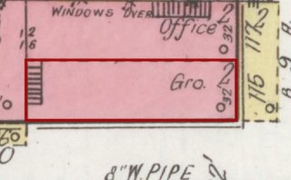
Grocery

Today

1921 N. Spring numbers do not line up with today’s Public Square W addresses, so this card has no per-building match. See the side list below for who is on the west side today.
  • ThenHave an old photo of this storefront?Share it
  • NowSend us a photo of 115 N. Spring (1921) today.Send a photo

No then-and-now photos here yet. Photos stay yours. How to share

On the old maps: no. 115 on the 1921 map

Sept. 1921 Sanborn fire insurance map detail with the lot at 115 N. Spring (1921) outlined in red; the map labels it: Gro.
Then: 1921 map

Map: Sanborn Map Co., Sept. 1921, sheet 2, Library of Congress (public domain). Cropped; red outline added by Our Town Almanac.

  1. 1921 Grocery map label: Gro. Library of Congress, sheet 2

West side · Public Square W

113 N. Spring St.

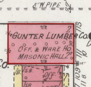
Gunter Lumber Co. office and warehouse; Masonic Hall on the 2nd floor

Today

1921 N. Spring numbers do not line up with today’s Public Square W addresses, so this card has no per-building match. See the side list below for who is on the west side today.
  • ThenHave an old photo of this storefront?Share it
  • NowSend us a photo of 113 N. Spring (1921) today.Send a photo

No then-and-now photos here yet. Photos stay yours. How to share

On the old maps: no. 113 on the 1921 map

Sept. 1921 Sanborn fire insurance map detail with the lot at 113 N. Spring (1921) outlined in red; the map labels it: Gunter Lumber Co.; Masonic Hall 2nd
Then: 1921 map

Map: Sanborn Map Co., Sept. 1921, sheet 2, Library of Congress (public domain). Cropped; red outline added by Our Town Almanac.

  1. 1921 Gunter Lumber Co. office and warehouse; Masonic Hall on the 2nd floor map label: Gunter Lumber Co.; Masonic Hall 2nd Library of Congress, sheet 2

1982 historic-district record: NRHP entry #42. NRHP #42 Shelbyville Benevolent Lodge ca. 1930s Art Deco at 111 Spring — later building on this frontage. (NRHP nomination 82001725)

West side · Public Square W

111 N. Spring St.

Gunter Lumber Co.; Masonic Hall on the 2nd floor

Today

1921 N. Spring numbers do not line up with today’s Public Square W addresses, so this card has no per-building match. See the side list below for who is on the west side today.
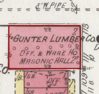
  • ThenHave an old photo of this storefront?Share it
  • NowSend us a photo of 111 N. Spring (1921) today.Send a photo

No then-and-now photos here yet. Photos stay yours. How to share

On the old maps: no. 111 on the 1921 map

Sept. 1921 Sanborn fire insurance map detail with the lot at 111 N. Spring (1921) outlined in red; the map labels it: Gunter Lumber Co.; Masonic Hall 2nd
Then: 1921 map

Map: Sanborn Map Co., Sept. 1921, sheet 2, Library of Congress (public domain). Cropped; red outline added by Our Town Almanac.

  1. 1921 Gunter Lumber Co.; Masonic Hall on the 2nd floor map label: Gunter Lumber Co.; Masonic Hall 2nd Library of Congress, sheet 2

1982 historic-district record: NRHP entry #42. (NRHP nomination 82001725)

West side · Public Square W

109 N. Spring St.

Office

Today

1921 N. Spring numbers do not line up with today’s Public Square W addresses, so this card has no per-building match. See the side list below for who is on the west side today.
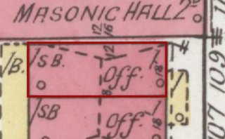
  • ThenHave an old photo of this storefront?Share it
  • NowSend us a photo of 109 N. Spring (1921) today.Send a photo

No then-and-now photos here yet. Photos stay yours. How to share

On the old maps: no. 109 on the 1921 map

Sept. 1921 Sanborn fire insurance map detail with the lot at 109 N. Spring (1921) outlined in red; the map labels it: Off.
Then: 1921 map

Map: Sanborn Map Co., Sept. 1921, sheet 2, Library of Congress (public domain). Cropped; red outline added by Our Town Almanac.

  1. 1921 Office map label: Off. Library of Congress, sheet 2

West side · Public Square W

107 N. Spring St.

Office

Today

1921 N. Spring numbers do not line up with today’s Public Square W addresses, so this card has no per-building match. See the side list below for who is on the west side today.
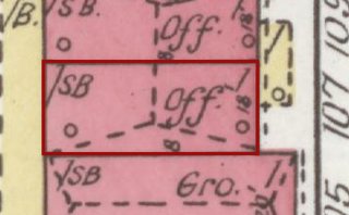
  • ThenHave an old photo of this storefront?Share it
  • NowSend us a photo of 107 N. Spring (1921) today.Send a photo

No then-and-now photos here yet. Photos stay yours. How to share

On the old maps: no. 107 on the 1921 map

Sept. 1921 Sanborn fire insurance map detail with the lot at 107 N. Spring (1921) outlined in red; the map labels it: Off.
Then: 1921 map

Map: Sanborn Map Co., Sept. 1921, sheet 2, Library of Congress (public domain). Cropped; red outline added by Our Town Almanac.

  1. 1921 Office map label: Off. Library of Congress, sheet 2

West side · Public Square W

105 N. Spring St.

Grocery

Today

1921 N. Spring numbers do not line up with today’s Public Square W addresses, so this card has no per-building match. See the side list below for who is on the west side today.
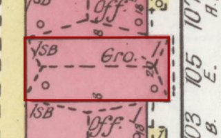
  • ThenHave an old photo of this storefront?Share it
  • NowSend us a photo of 105 N. Spring (1921) today.Send a photo

No then-and-now photos here yet. Photos stay yours. How to share

On the old maps: no. 105 on the 1921 map

Sept. 1921 Sanborn fire insurance map detail with the lot at 105 N. Spring (1921) outlined in red; the map labels it: Gro.
Then: 1921 map

Map: Sanborn Map Co., Sept. 1921, sheet 2, Library of Congress (public domain). Cropped; red outline added by Our Town Almanac.

  1. 1921 Grocery map label: Gro. Library of Congress, sheet 2

1982 historic-district record: NRHP entry #41. NRHP #41 Gunter Building 1929, five-story yellow glazed brick Art Deco at 105 Spring — replaced this grocery frontage. (NRHP nomination 82001725)

West side · Public Square W

103 N. Spring St.

Office

Today

1921 N. Spring numbers do not line up with today’s Public Square W addresses, so this card has no per-building match. See the side list below for who is on the west side today.
  • ThenHave an old photo of this storefront?Share it
  • NowSend us a photo of 103 N. Spring (1921) today.Send a photo

No then-and-now photos here yet. Photos stay yours. How to share

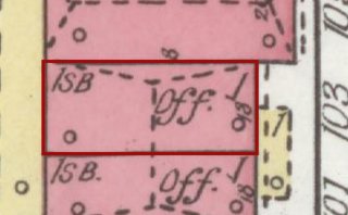
On the old maps: no. 103 on the 1921 map

Sept. 1921 Sanborn fire insurance map detail with the lot at 103 N. Spring (1921) outlined in red; the map labels it: Off.
Then: 1921 map

Map: Sanborn Map Co., Sept. 1921, sheet 2, Library of Congress (public domain). Cropped; red outline added by Our Town Almanac.

  1. 1921 Office map label: Off. Library of Congress, sheet 2

West side · Public Square W

101 N. Spring St.

Office

Today

1921 N. Spring numbers do not line up with today’s Public Square W addresses, so this card has no per-building match. See the side list below for who is on the west side today.
  • ThenHave an old photo of this storefront?Share it
  • NowSend us a photo of 101 N. Spring (1921) today.Send a photo

No then-and-now photos here yet. Photos stay yours. How to share

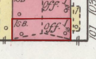
On the old maps: no. 101 on the 1921 map

Sept. 1921 Sanborn fire insurance map detail with the lot at 101 N. Spring (1921) outlined in red; the map labels it: Off.
Then: 1921 map

Map: Sanborn Map Co., Sept. 1921, sheet 2, Library of Congress (public domain). Cropped; red outline added by Our Town Almanac.

  1. 1921 Office map label: Off. Library of Congress, sheet 2

On the west side today

Because 1921 N. Spring numbers do not match today’s Public Square W numbers, these listings are shown as a side list, not per card.

From our directory, Nov. 1, 2026.

← Every building on the square