Fayetteville, Pulaski, Lynchburg and Shelbyville sit within an hour of each other. These drives take the back roads where it makes sense, with places to stop on the way. Mileage and times are estimates from OpenStreetMap routing; county roads are slower than the highway, so leave extra time. Every fact links to where we found it.
If something has changed, tell us and we will fix it.
Walking or biking between towns? No walking, hiking or biking trail connects any of our towns today. Each town has its own short paths and parks (see Get outside below). Some state-mapped bicycle routes use these same roads, shared with traffic.
Please pull off only at parks, public lots and marked spaces, never on a highway shoulder or private land. Hours and fees change: check before you go.
A six-arch limestone bridge with no keystone, completed in 1861 near the site of the Great Indian Crossing, carried traffic over the Elk River until it collapsed after heavy rain on February 2, 1969. The state marker says its remains lie just south of the marker.
Hidden gem: The state marker calls it one of only six bridges of its type in the world.
Photo spot: The surviving arches and the Elk River. Pull off: Park in the Stone Bridge Park lot (2010 Thornton Taylor Pkwy), not on the US 64 bypass shoulder. Suggestion: soft morning light; fall color along the river.
Yes. State historical marker on Wilson Parkway; the city's Stone Bridge Park is next door. · Hours: Stone Bridge Park: 5 a.m. to 8 p.m. (city parks page). · Fees: Free · Allow 15-20 minutes
Trail of Tears Bell Route marker, Stone Bridge Park
A marker at the park entrance notes that the Bell detachment of the Cherokee removal passed through Fayetteville and Pulaski in 1838 on a road close to today's US 64. An officer's letter quoted on the marker reported traveling 10 to 12 miles a day.
Yes, at the Stone Bridge Park entrance. · Hours: Park: 5 a.m. to 8 p.m. · Fees: Free · Allow 10 minutes
An unincorporated community on TN 50, 7.4 miles northeast of Fayetteville, named for the red mulberry plants found in the area. Its post office (ZIP 37359) opened on January 7, 1828.
Hidden gem: Its post office opened in 1828.
Public roads only; the drive uses the short Old Lynchburg Highway loop through the community. · Hours: n/a · Fees: Free · Allow Drive-through, 5 minutes
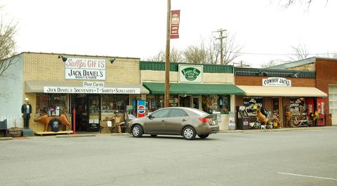
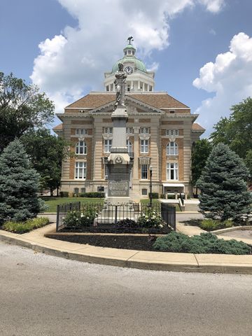
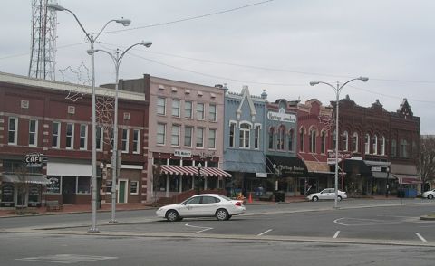
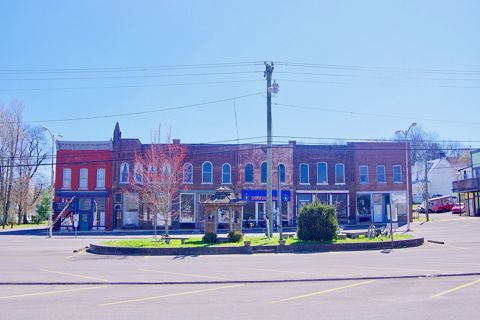
Shops along the courthouse square in Lynchburg, Tennessee, United States. Photo: Brian Stansberry, CC BY 3.0, Wikimedia Commons (resized).
Lynchburg's consolidated city-county government covers all of Moore County. The square around the Moore County Courthouse is the town center.
Photo spot: The courthouse and storefronts around the square. Pull off: Marked public parking spaces around the square only. Suggestion: early morning on a weekday, before visitor traffic.
A six-arch limestone bridge with no keystone, completed in 1861 near the site of the Great Indian Crossing, carried traffic over the Elk River until it collapsed after heavy rain on February 2, 1969. The state marker says its remains lie just south of the marker.
Hidden gem: The state marker calls it one of only six bridges of its type in the world.
Photo spot: The surviving arches and the Elk River. Pull off: Park in the Stone Bridge Park lot (2010 Thornton Taylor Pkwy), not on the US 64 bypass shoulder. Suggestion: soft morning light; fall color along the river.
Yes. State historical marker on Wilson Parkway; the city's Stone Bridge Park is next door. · Hours: Stone Bridge Park: 5 a.m. to 8 p.m. (city parks page). · Fees: Free · Allow 15-20 minutes
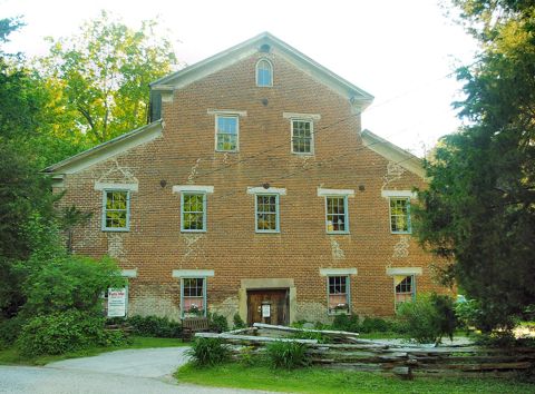
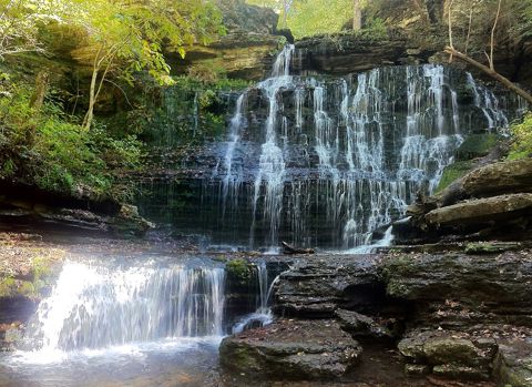
A rural textile factory built in 1873 and listed on the National Register in 1972, now a museum of antique machinery, looms and mill stones, with a water wheel and falls on the grounds. Exhibits include a dog-powered butter churn.
Hidden gem: An 1873 mill with a working water wheel tucked down a county road off US 64.
Photo spot: The water wheel, the mill and the lower falls. Pull off: Mill visitor parking during open hours only. Suggestion: mid-morning; spring flow or October color.
Good for kids and field trips: Group tours of 20 or more by reservation, any day; school groups are on the mill's calendar.
Yes, privately run museum open to the public · Hours: Thursday-Saturday, 9 a.m.-4 p.m. Central, April-November, per the mill's site (Oct. 19, 2026). · Fees: Adults $7; seniors, students and military $6; children under 14 $5, per the mill's site (Oct. 19, 2026). · Allow 45-75 minutes
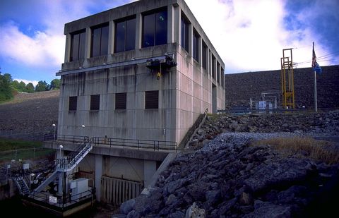
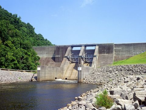
TVA's Tims Ford Dam on the Elk River forms Tims Ford Lake, about 10,700 acres with roughly 250 miles of shoreline. TWRA lists a free concrete boat ramp at the dam.
Photo spot: The dam face and the tailwater. Pull off: The TWRA/TVA ramp parking area only. Suggestion: clear winter mornings when the trees are bare.
Yes, TVA/TWRA public ramp · Hours: Not stated · Fees: Free (TWRA record) · Allow 15 minutes
Tims Ford Lake at sunset, Winchester shore. Photo: Brian Stansberry, CC BY 3.0, Wikimedia Commons (resized).
A 3,546-acre state park on Tims Ford Reservoir with about seven miles of paved biking and hiking trails, a lakeshore mountain-bike trail of more than 16 miles out and back, a marina and a paddle blueway. The park's brochure puts it 12 miles from historic Lynchburg.
Photo spot: Lake views from the park's wheelchair-friendly overlooks. Pull off: Park lots only. Suggestion: sunset over the water.
Good for kids and field trips: Playground, aviary and accessible paved trails; ranger- and teacher-led school programs are offered.
Yes · Hours: Visitor center 8 a.m.-4:30 p.m. daily · Fees: No entrance fee (TN State Parks); fees for camping, cabins, rentals · Allow 1-3 hours
Shops along the courthouse square in Lynchburg, Tennessee, United States. Photo: Brian Stansberry, CC BY 3.0, Wikimedia Commons (resized).
Lynchburg's consolidated city-county government covers all of Moore County. The square around the Moore County Courthouse is the town center.
Photo spot: The courthouse and storefronts around the square. Pull off: Marked public parking spaces around the square only. Suggestion: early morning on a weekday, before visitor traffic.
Fayetteville to Pulaski on the Boonshill and Center Point roads
32 miles · about 1 hr 16 min
Fastest way: 30 miles, about 36 minutes.
Roads in order: College Street West (US 64 Business) (0.5 mi) → Washington Street West (US 64 Business) (0.8 mi) → Pulaski Highway (US 64) (9.6 mi) → Red Oak Road (6.6 mi) → Center Point Road (3.4 mi) → Beech Hill Road (8.9 mi) → East Jefferson Street (1.3 mi)
Trail of Tears Bell Route marker, Stone Bridge Park
A marker at the park entrance notes that the Bell detachment of the Cherokee removal passed through Fayetteville and Pulaski in 1838 on a road close to today's US 64. An officer's letter quoted on the marker reported traveling 10 to 12 miles a day.
Yes, at the Stone Bridge Park entrance. · Hours: Park: 5 a.m. to 8 p.m. · Fees: Free · Allow 10 minutes
Red Oak and Center Point roads (Trail of Tears Bell Route alignment)
Best stopHidden gem
West of Fayetteville the Bell detachment of about 650-700 Cherokee followed the general alignment of Boonshill Road, then a route similar to Red Oak and Center Point roads through Beech Hill and Friendship, reaching Pulaski on November 3 or 4, 1838, according to the Pulaski marker.
Hidden gem: These quiet county roads follow the general line of a forced removal route from 1838.
Public county roads; no stopping on the roadway · Hours: n/a · Fees: Free · Allow Drive-through
Pulaski/Giles County Trail of Tears Memorial and Interpretive Center, Pleasant Run Park
Best stopGood for kids/field trips
The memorial in Pleasant Run Park has an interpretive center, outdoor signs, a statue representing a Cherokee family, and the Pleasant Run Eco-Trail with labeled trees along the creek. Two removal detachments passed through Giles County in October and November 1838.
Good for kids and field trips: Outdoor signs and a short labeled-tree trail suit a class visit.
Yes, city park · Hours: Grounds open daily; the indoor center is by appointment (Native History Association). · Fees: Free · Allow 30-45 minutes
A boardwalk platform near W. Cemetery St. and S. 3rd St. looks down on stone pilings of the old Richland Creek bridge, where both the Benge and Bell detachments crossed in 1838.
Hidden gem: The stone supports of the bridge the detachments crossed are still visible from the boardwalk.
Photo spot: Richland Creek and the old stone pilings. Pull off: From the public boardwalk; park on a legal city street. Suggestion: low water in late summer shows the pilings best.
A free TWRA access with a gravel ramp on Richland Creek just west of Pulaski. The Pulaski Bell Route marker says the 1838 road continued west on Vales Mill Road.
Hidden gem: A creek put-in on the same road the 1838 removal route followed out of Pulaski.
Shops along the courthouse square in Lynchburg, Tennessee, United States. Photo: Brian Stansberry, CC BY 3.0, Wikimedia Commons (resized).
Lynchburg's consolidated city-county government covers all of Moore County. The square around the Moore County Courthouse is the town center.
Photo spot: The courthouse and storefronts around the square. Pull off: Marked public parking spaces around the square only. Suggestion: early morning on a weekday, before visitor traffic.
A 420-acre natural area about 3.5 miles northeast of Tullahoma where Machine Falls drops more than 60 feet; Upper and Lower Busby Falls can be seen from overlooks on the Bobo Creek trail. TDEC calls it one of the best spring wildflower sites in the state.
Hidden gem: A 60-foot waterfall a few minutes from downtown Tullahoma.
Photo spot: Machine Falls from the base of the trail. Pull off: Designated Short Springs parking only (Short Springs Rd). TDEC: seeps are most impressive in the wet winter and spring months; spring wildflowers.
Yes (State of Tennessee, TVA and City of Tullahoma) · Hours: Not stated · Fees: Free · Allow 1.5-2 hours (Machine Falls and back)
Normandy, population 108 in 2020, is listed on the National Register as the Normandy Historic District (1985). The town grew up in 1852 when the railroad reached Norman's Creek.
Hidden gem: A town of about a hundred people where the whole town is a National Register district.
TVA completed Normandy Dam on the Duck River in 1976 for flood control and economic development; it is 110 feet high and does not produce electricity. TWRA lists a free concrete boat ramp at the dam and nearby ramps at Barton Springs, Cedar Point and Boyd's Branch.
Photo spot: The dam and the lake behind it. Pull off: The TWRA 'Boat Ramp at Dam' parking area. Suggestion: late afternoon light across the lake.
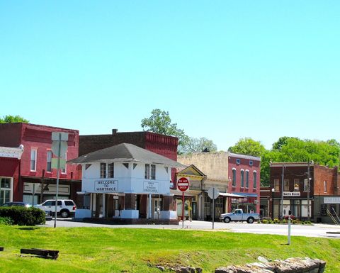
Walking Horse Hotel, Wartrace (private property). Photo: Brian Stansberry, CC BY 3.0, Wikimedia Commons (resized).
Strolling Jim, the first World's Champion Tennessee Walking Horse, won at the first Celebration at Shelbyville in 1939 and is buried in a pasture behind the Walking Horse Hotel, according to the state marker.
Hidden gem: A world champion horse is buried behind a small-town hotel.
The marker is public, on Blackman Blvd W (TN 64). The grave is in a pasture on private hotel property; view the marker only unless the property invites visitors. · Hours: n/a · Fees: Free · Allow 10 minutes
The breed's national museum at 27 Main St. E. in Wartrace, a town nicknamed 'the cradle of the Tennessee Walking Horse' that has held a horse show every year since 1906.
Photo spot: Wartrace's historic downtown and the Walking Horse Hotel front. Pull off: Marked downtown parking only. Suggestion: golden hour on Main Street.
Good for kids and field trips: Private group tours can be arranged by phone.
Yes · Hours: Friday and Saturday, 10 a.m.-4 p.m., per the museum's site (Oct. 19, 2026); group tours by arrangement. · Fees: Not posted on the hours page. · Allow 30-45 minutes
Buildings along Main Street (SR 269) in Bell Buckle, Tennessee, United States.. Photo: Brian Stansberry, CC BY 3.0, Wikimedia Commons (resized).
A Bedford County town of 410 people (2020) whose downtown is the Bell Buckle Historic District on the National Register. It is about 4.5 miles north of Wartrace in a straight line.
Duck River at River Bottom Park and the Duck River Greenway
Photo spot
A 19-acre city park on the Duck River with a TWRA-listed concrete boat ramp. A TDOT-funded project advertised for bids in September 2026 will rebuild the 0.286-mile Duck River Greenway from the park to South Cannon Blvd. and add a 1,200 sq. ft. scenic river overlook.
Photo spot: The Duck River from the park bank (and the new overlook once built). Pull off: River Bottom Park lot. Suggestion: early morning mist on the river in fall.
Nearby (from our free directory, A–Z): Barton Springs Grocery & Bait · Bedford County Tactical · Bedford Tack · Bell Buckle Cafe · Bell Buckle Coffee Shop & Book Swap · Bell Buckle Nutrition & Energy · Blue Bird Antiques · Brandy’s Diner · Chabbi's Sweets & Eats · Collectors General Store · Custom Lawn Jockeys · Deason Gifts and More · Doodle Bug · Farm Girlz Goodz · Granny Fishes' House · Hilltop Antiques · JR's Antiques · Krazy Katy's · Livery Stable Antique Mall · Midland Market & Deli · Phillips General Store · Rock House Deli · Sage Dining Services Inc · Shady Acres Creations, LLC Boutique and More · Southern Charm Bell Buckle · Southern Goods Mercantile · Strawberry Moon Catering · Tennessee Walking Horse National Museum · The Iron Horse · The Shoppes at 31 Main · The Sparrow's Nest · The Wartrace Emporium · Valley View Market · Wartrace Country Store · Wartrace Headstart Center
Roads in order: South Cannon Boulevard (US 231; SR 64; SR 130) (12.2 mi) → Petersburg-Chestnut Ridge Road (SR 129) (6.7 mi) → Railroad Street (SR 129) (0.4 mi) → South High Street (0.6 mi) → Lewisburg Highway (US 431) (11.3 mi) → Main Avenue North (US 431) (0.4 mi)
The city's comprehensive plan says the design of Shelbyville's square, known as the 'Shelbyville Plan,' has been a template for numerous communities.
Hidden gem: The layout of this square is called the 'Shelbyville Plan' and was copied by other towns, per the city plan.
Photo spot: The Bedford County Courthouse in the middle of the square. Pull off: Marked public spaces around the square. Suggestion: Sunday morning, light traffic.
A six-arch limestone bridge with no keystone, completed in 1861 near the site of the Great Indian Crossing, carried traffic over the Elk River until it collapsed after heavy rain on February 2, 1969. The state marker says its remains lie just south of the marker.
Hidden gem: The state marker calls it one of only six bridges of its type in the world.
Photo spot: The surviving arches and the Elk River. Pull off: Park in the Stone Bridge Park lot (2010 Thornton Taylor Pkwy), not on the US 64 bypass shoulder. Suggestion: soft morning light; fall color along the river.
Yes. State historical marker on Wilson Parkway; the city's Stone Bridge Park is next door. · Hours: Stone Bridge Park: 5 a.m. to 8 p.m. (city parks page). · Fees: Free · Allow 15-20 minutes
In October 1813 about 3,500 Tennessee militiamen mobilized here under Maj. Gen. Andrew Jackson for operations in what is now Alabama. The city's outdoors page links the site to Tennessee's 'Volunteer State' nickname.
Yes. State marker on Huntsville Hwy (US 231/431); several more markers stand at the nearby Camp Blount Historic Site. · Hours: Not stated · Fees: Free · Allow 10-15 minutes
Pulaski/Giles County Trail of Tears Memorial and Interpretive Center, Pleasant Run Park
Good for kids/field trips
The memorial in Pleasant Run Park has an interpretive center, outdoor signs, a statue representing a Cherokee family, and the Pleasant Run Eco-Trail with labeled trees along the creek. Two removal detachments passed through Giles County in October and November 1838.
Good for kids and field trips: Outdoor signs and a short labeled-tree trail suit a class visit.
Yes, city park · Hours: Grounds open daily; the indoor center is by appointment (Native History Association). · Fees: Free · Allow 30-45 minutes
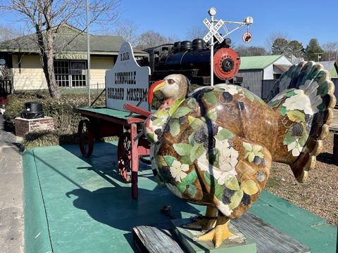
A free, self-guided museum at 162 Mill St. where visitors can board a 1927 Baldwin 2-6-2 Prairie-type steam locomotive, a 1920s passenger coach and a caboose, across the street from Lynnville's 19th-century business district.
Hidden gem: You can sit in the engineer's seat of a 98-ton steam locomotive for free.
Photo spot: The steam locomotive and depot. Pull off: Museum or town parking on Mill St.. Suggestion: morning light on the platform.
Good for kids and field trips: Children can climb into the locomotive cab; guided group tours by reservation through Lynnville City Hall (931-527-3158).
A 1,552-acre state park on the Duck River near Chapel Hill with trails, the remnants of the historic Wilhoite Mill and bridge, a Duck River education room with two large aquariums, and a 1-mile Duck River blueway.
Good for kids and field trips: The visitor center's Duck River room has aquariums and a touchscreen river map; summer guided kayak floats.
Duck River at River Bottom Park and the Duck River Greenway
Best stopPhoto spot
A 19-acre city park on the Duck River with a TWRA-listed concrete boat ramp. A TDOT-funded project advertised for bids in September 2026 will rebuild the 0.286-mile Duck River Greenway from the park to South Cannon Blvd. and add a 1,200 sq. ft. scenic river overlook.
Photo spot: The Duck River from the park bank (and the new overlook once built). Pull off: River Bottom Park lot. Suggestion: early morning mist on the river in fall.
The city's comprehensive plan says the design of Shelbyville's square, known as the 'Shelbyville Plan,' has been a template for numerous communities.
Hidden gem: The layout of this square is called the 'Shelbyville Plan' and was copied by other towns, per the city plan.
Photo spot: The Bedford County Courthouse in the middle of the square. Pull off: Marked public spaces around the square. Suggestion: Sunday morning, light traffic.
Nearby (from our free directory, A–Z): 11:37 Art Studio · All Stop · Amigo's Mexican Grill Lynnville · Berkleys Deli And Market · Big Machine Distillery · Col. Littleton Ltd., Inc. · FLAG SPRINGS MARKET · Lynnville EZ Stop · Lynnville Fried Pie Company · Lynnville Railroad Museum · Richland Market · Soda Pop Junction
A six-arch limestone bridge with no keystone, completed in 1861 near the site of the Great Indian Crossing, carried traffic over the Elk River until it collapsed after heavy rain on February 2, 1969. The state marker says its remains lie just south of the marker.
Hidden gem: The state marker calls it one of only six bridges of its type in the world.
Photo spot: The surviving arches and the Elk River. Pull off: Park in the Stone Bridge Park lot (2010 Thornton Taylor Pkwy), not on the US 64 bypass shoulder. Suggestion: soft morning light; fall color along the river.
Yes. State historical marker on Wilson Parkway; the city's Stone Bridge Park is next door. · Hours: Stone Bridge Park: 5 a.m. to 8 p.m. (city parks page). · Fees: Free · Allow 15-20 minutes
Red Oak and Center Point roads (Trail of Tears Bell Route alignment)
Hidden gem
West of Fayetteville the Bell detachment of about 650-700 Cherokee followed the general alignment of Boonshill Road, then a route similar to Red Oak and Center Point roads through Beech Hill and Friendship, reaching Pulaski on November 3 or 4, 1838, according to the Pulaski marker.
Hidden gem: These quiet county roads follow the general line of a forced removal route from 1838.
Public county roads; no stopping on the roadway · Hours: n/a · Fees: Free · Allow Drive-through
Pulaski/Giles County Trail of Tears Memorial and Interpretive Center, Pleasant Run Park
Good for kids/field trips
The memorial in Pleasant Run Park has an interpretive center, outdoor signs, a statue representing a Cherokee family, and the Pleasant Run Eco-Trail with labeled trees along the creek. Two removal detachments passed through Giles County in October and November 1838.
Good for kids and field trips: Outdoor signs and a short labeled-tree trail suit a class visit.
Yes, city park · Hours: Grounds open daily; the indoor center is by appointment (Native History Association). · Fees: Free · Allow 30-45 minutes
A free, self-guided museum at 162 Mill St. where visitors can board a 1927 Baldwin 2-6-2 Prairie-type steam locomotive, a 1920s passenger coach and a caboose, across the street from Lynnville's 19th-century business district.
Hidden gem: You can sit in the engineer's seat of a 98-ton steam locomotive for free.
Photo spot: The steam locomotive and depot. Pull off: Museum or town parking on Mill St.. Suggestion: morning light on the platform.
Good for kids and field trips: Children can climb into the locomotive cab; guided group tours by reservation through Lynnville City Hall (931-527-3158).
The city's comprehensive plan says the design of Shelbyville's square, known as the 'Shelbyville Plan,' has been a template for numerous communities.
Hidden gem: The layout of this square is called the 'Shelbyville Plan' and was copied by other towns, per the city plan.
Photo spot: The Bedford County Courthouse in the middle of the square. Pull off: Marked public spaces around the square. Suggestion: Sunday morning, light traffic.
Walking Horse Hotel, Wartrace (private property). Photo: Brian Stansberry, CC BY 3.0, Wikimedia Commons (resized).
Strolling Jim, the first World's Champion Tennessee Walking Horse, won at the first Celebration at Shelbyville in 1939 and is buried in a pasture behind the Walking Horse Hotel, according to the state marker.
Hidden gem: A world champion horse is buried behind a small-town hotel.
The marker is public, on Blackman Blvd W (TN 64). The grave is in a pasture on private hotel property; view the marker only unless the property invites visitors. · Hours: n/a · Fees: Free · Allow 10 minutes
Normandy, population 108 in 2020, is listed on the National Register as the Normandy Historic District (1985). The town grew up in 1852 when the railroad reached Norman's Creek.
Hidden gem: A town of about a hundred people where the whole town is a National Register district.
Shops along the courthouse square in Lynchburg, Tennessee, United States. Photo: Brian Stansberry, CC BY 3.0, Wikimedia Commons (resized).
Lynchburg's consolidated city-county government covers all of Moore County. The square around the Moore County Courthouse is the town center.
Photo spot: The courthouse and storefronts around the square. Pull off: Marked public parking spaces around the square only. Suggestion: early morning on a weekday, before visitor traffic.
Nearby (from our free directory, A–Z): 11:37 Art Studio · All Stop · Amigo's Mexican Grill Lynnville · Barton Springs Grocery & Bait · Berkleys Deli And Market · Big Machine Distillery · Brandy’s Diner · Chabbi's Sweets & Eats · Col. Littleton Ltd., Inc. · FLAG SPRINGS MARKET · Granny Fishes' House · Krazy Katy's · Lynnville EZ Stop · Lynnville Fried Pie Company · Lynnville Railroad Museum · Richland Market · Rock House Deli · Soda Pop Junction · Southern Goods Mercantile · Strawberry Moon Catering · Tennessee Walking Horse National Museum · The Iron Horse · The Shoppes at 31 Main · The Sparrow's Nest · The Wartrace Emporium · Valley View Market · Wartrace Country Store · Wartrace Headstart Center
Everyone age 13 and older needs a Tennessee fishing license; residents 13-15 can buy a $9 Junior Hunt, Fish & Trap license. Some TWRA lakes also require a lake permit for anglers 16-64.
Below Tims Ford and Normandy dams, TVA warns that release schedules can change without notice and large amounts of water can be discharged at any time. Check the TVA lake page before wading or paddling.
Check live river levels before paddling: USGS Elk River above Fayetteville (03582000), Richland Creek at Pulaski (03584045), Elk River at Prospect (03584600), Duck River at Shelbyville (03597860) and Duck River below Manchester (03596000).
We list no swimming holes. Swim only where a park lists swimming and lifeguard or posted rules allow it; obey every 'No swimming' sign. Tims Ford State Park warns the lake is a drowning risk and life jackets should always be worn.
TWRA says its access sites are generally open to the public, but restrictions may apply and the map is a guide only; know the land ownership and rules where you go.
Fayetteville: 12 places (top picks: Stone Bridge Park; Joy Gleghorn Nature Preserve at Wells Hill Park; Don Davidson / Lions Club Complex and Dog Park)
Camp Blount Historic Site
Good for kids/field trips
Historic site · City of Fayetteville · about 1 min / 0.8 mi from the square
The War of 1812 muster ground beside the Elk River, with several historical markers.
Amenities: Markers · Hours: Not stated · Fees: Free
Good for kids and field trips: A strong field-trip link to Tennessee's 'Volunteer State' nickname.
City park / Elk River · City of Fayetteville · about 2 min / 0.8 mi from the square
A memorial park beside the Elk River honoring the historic Stone Bridge, with the visitor center, a pond with duck and goose food dispensers, a stage, pavilions and swings along the river.
Amenities: Pavilions (reservable), outdoor seating, stage; handicap and wheelchair accessible; paddle-craft launch with accessible parking (TWRA record) · Hours: 5 a.m.-8 p.m. · Fees: Free; pavilion rental through the Rec Center
Good for kids and field trips: Feeding the ducks and the history markers make an easy outing.
Fayetteville Greenway + Blueway Master Plan (planned)
Planned greenway / blueway · City of Fayetteville / TDOT grants · about 2 min / 0.8 mi from the square
TDOT awarded grants for a Square-to-Stone Bridge Park connector along Norris Creek (2015, $313,432) and a Stone Bridge Park-to-Camp Blount connector with a pedestrian truss bridge over the Elk River (2017, $1,099,037). Current construction status not confirmed.
Recreation complex · City of Fayetteville · about 3 min / 1.8 mi from the square
A walking trail around a lake with a wooded nature-trail extension, a kids trail, an 18-hole disc golf course, six ball fields, volleyball, fishing and a fenced dog park behind the complex.
Amenities: Pavilions, dog park with water stations and a separate area for shy dogs · Hours: 5 a.m.-8 p.m. (dog park) · Fees: Free
Good for kids and field trips: Kids trail and disc golf.
County park / nature preserve / waterfalls · Lincoln County (conservation easement held by TennGreen) · about 8 min / 4.1 mi from the square
A 114-acre county park and nature preserve with a 3.2-mile out-and-back trail up the hollow to small waterfalls, including two-drop Rainy Falls, and remnants of Fayetteville's 1899 gravity-flow water system.
Amenities: Parking area, pavilion with picnic tables · Hours: Not stated · Fees: Not stated
Pulaski: 8 places (top picks: Pleasant Run Park, Eco-Trail and Trail of Tears Memorial; David Crockett State Park; Lynnville Railroad Museum)
Pleasant Run Park, Eco-Trail and Trail of Tears Memorial
Good for kids/field trips
City park / history / nature trail · City of Pulaski; interpretive center with Native History Association information · about 1 min / 0.3 mi from the square
A city park with the Pulaski/Giles County Trail of Tears Memorial and the Pleasant Run Eco-Trail along Pleasant Run creek, where many trees are labeled and picnic tables sit in the shade.
Amenities: Picnic tables, trail, outdoor exhibits · Hours: Grounds daily; indoor center by appointment · Fees: Free
Good for kids and field trips: Labeled-tree trail and outdoor exhibits suit a class visit.
State park / waterfall · Tennessee State Parks · about 30 min / 20.0 mi from the square
A 1,400-acre park in Lawrenceburg with a museum, a reconstructed water-powered gristmill, Crockett Falls and limestone bluffs along Shoal Creek, plus Lake Lindsey.
Amenities: Visitor center, museum, campground, cabins, playground, pavilions, boat and paddle rentals, all-terrain wheelchair · Hours: Visitor center 8 a.m.-4 p.m. · Fees: No entrance fee; activity fees
Note: The park warns of flash flooding in Shoal Creek.
Good for kids and field trips: Museum and working gristmill.
Lynchburg: 9 places (top picks: Tims Ford State Park; Short Springs State Natural Area; Tims Ford Blueway paddle trail)
Wiseman Park
Good for kids/field trips
County park / campground · Metro Lynchburg-Moore County · about 1 min / 0.3 mi from the square
A county park behind the downtown square with a playground, picnic area, two public hard-surface tennis courts and first-come RV sites.
Amenities: Playground, picnic area, restrooms, tennis courts, RV hookups and dump station (third-party listings) · Hours: Not stated · Fees: RV camping fees are not posted on an official page.
Good for kids and field trips: Playground a short walk from the square.
These details come from third-party listings only.
State park / lake · Tennessee State Parks · about 28 min / 13.2 mi from the square
A 3,546-acre lake park with about seven miles of paved bike and hike paths, a shoreline mountain-bike and hiking trail of more than 16 miles out and back, campgrounds, cabins, a marina, swimming and a paddle blueway.
Amenities: Visitor center, playground, aviary, accessible fishing pier, all-terrain wheelchairs, camp store, boat rentals · Hours: Visitor center 8 a.m.-4:30 p.m. · Fees: No entrance fee; activity fees
Good for kids and field trips: Ranger- and teacher-led school programs.
Paddle trail · Tennessee State Parks / TVA · about 32 min / 14.1 mi from the square
A multi-route paddle trail on Tims Ford Lake; from the state park's Lakeview Marina it is 0.5 mile to Leatherwood Island and a 3-mile round trip to Kitchen Creek. Launches include Turkey Creek, Lost Creek, Anderton Branch and Pleasant Grove.
Amenities: Multiple launches · Hours: n/a · Fees: Free to paddle; launch fees may apply at marinas
Shelbyville: 14 places (top picks: H.V. Griffin Park and Shelbyville Recreation Center; River Bottom Park and Duck River Greenway; Henry Horton State Park)
Duck River at Fishermans Park (TWRA access)
Streamside fishing / paddle access · Tennessee Wildlife Resources Agency (site record) · about 1 min / 0.4 mi from the square
Public boating and fishing access on Duck River in Bedford County.
Amenities: Restroom flag in TWRA record: no; accessible parking flag: yes · Hours: Not stated · Fees: Free
City park / river access · City of Shelbyville · about 3 min / 1.0 mi from the square
A 19-acre riverside park with a boat ramp (TWRA: 'Shelbyville City Park') and the 0.286-mile Duck River Greenway, which TDOT advertised for reconstruction with a new scenic overlook in September 2026.
H.V. Griffin Park and Shelbyville Recreation Center
Good for kids/field trips
Community park · City of Shelbyville · about 6 min / 2.1 mi from the square
The city's 142-acre community park at 220 Tulip Tree Road with the recreation center, sports fields, tennis courts, batting cages, a skate park, playgrounds, pavilions, a splash pad, a dog park and a free 18-hole disc golf course.
Amenities: Recreation center (memberships), restrooms, pavilions, splash pad, playgrounds, accessible entrances · Hours: Recreation center hours vary; see city page · Fees: Park free; rec center memberships
Good for kids and field trips: Splash pad, playgrounds and skate park.
State park / Duck River · Tennessee State Parks · about 31 min / 18.6 mi from the square
A 1,552-acre Duck River park with river and wetland trails, a 1.5-mile accessible greenway, a 1-mile blueway, Wilhoite Mill remnants, a disc golf course and a Duck River education room with aquariums.
Boating access data: Tennessee Wildlife Resources Agency. Photos: Wikimedia Commons, credited under each image. We point to sources; we don’t make up facts.